-
Hyperhistory:
Maps
-
Map
History
-
Une
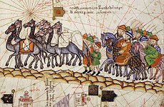
carte du monde au XIVe siècle: l'Atlas Catalan
-
20c
maps
-
Hyperhistory
-
Historical
maps
-
Historic
Maps *
-
British
Historical GIS Programme
-
Great
set of links to many maps
-
Historical
and Cultural Atlases
-
History
of Cartography
-
Russian
Empire 1882 atlas
-
Balkans
1882
atlas
Prehistòria
-
El
Neolítico en el mundo (pdf, 169 Kbs.)
-
East
Africa Early Man Discover Sites
-
OK
Map of Location of Olduvia George, Tanzania
-
South
African Early Man Sites
-
Map
of Mummy Discoveries
-
Map
of Cave Art in France
-
Map
of Alpine Rock Art Click on the names to see the images.
-
Human
Fossils in China 4 maps showing major sites.
-
Map
of Early Civilizations and Migration
-
Sea
Routes to Polynesia
-
Maps
to Stonehenge
-
Early
Maps on Clay Tablets Illustrations from 6200 B.C. to 400 A.D.
Antiga
-
Maps
for students
-
Cartografía.
Mapas de historia antigua · UCM *
-
El
Imperio de Alejandro Magno (pdf, 208 Kbs.)
-
La
expansión de Roma (pdf, 166 Kbs.)
-
Barrington
Atlas of the Greek and Roman World
-
Atlas
de historia antigua
-
Ancient
Maps 6,000 B.C. to 400 A.D.
-
Ancient
and Medieval Atlas
-
Abzu
Subject Index: Maps and Atlases
-
Atlas
historique de l'Antiquité tardive
-
Index
de l'Atlas historique de l'Antiquite tardive
-
Regions
geographiques de l'Atlas historique de l'Antiquite tardive
-
Classical
Atlas Project
-
Perseus
Atlas Project
-
Cartographic
Images: Ancient through Renaissance
-
Atlas
Historique: AD 1-1400
-
Cartographic
Images: Ancient through Renaissance
-
Rome:
Map of the Empire
-
NIPPUR,
Sacred City of Enlil, Supreme God of Sumer and Akkad
-
Classical
Atlas Project (University of Chicago)
-
Historical
and Cultural Atlases
Europe
Map Archive
Natural
Resources & Trade
Eastern
Mediterranean: natural resources
The
Aegean: natural resources
Western
Mediterranean: natural resources
Spain:
natural resources
Trade
in the Roman Empire
Ancient
Near East
Political
Change in Ancient Mesopotamia 3000-1000 BCE
The
Late Aegean Bronze Age: cities & palaces 1250-1000 BCE
Sea
Peoples: in the Late Bronze Age
Ancient
Near East: Empires from 700-300 BCE
Classical
Greece
Greece
in the Archaic Age: political structure in 750 - 490 BCE
Greeks
& Phoenicians: Colonization in the 9-6 Cent. BCE
Major
Temples and Sanctuaries in the Greek Homeland
Athenian
League & Peloponnesian War in 435 BCE
March
of the 10,000: 401-398 BCE
Hellenistic
World & Roman Republic
Macedonian
Expansion under Philip & Alexander
The
Hellenistic World: cities & empires in 240 BCE
The
Hellenistic World: major & minor states in 90 BCE
Major
Temples and Sanctuaries in the Roman Homeland
Roman
Empire Expansion
Second
Punic War: An Overview
Second
Punic War
Roman
Italy: Urbanization & Road Building
Principate
& Empire
Roman
World: Citizen communities outside the Italian homeland
Roman
World: urbanization in 2nd Cent. CE
The
Jewish Diaspora: in the 1st Cent. CE
Spread
of Christianity: 2nd-4th Cent. CE
Roman
World : origins of emperors
Theaters
outside the Greek and Roman Homelands: ca. 200 CE
Roman
World: Urbanization of Gaul
Spain
: urbanization
Roman
Frontier
Late
Antiquity & Early Midieval
Barbarian
Migrations in Late Antiquity
Suggested
Viking Routes: from 8th-11th Cent. CE
Medieval
-
Les
mappemondes: une image médiévalle du monde
-
Mapes
d'història medieval
-
Mapa
dels territoris conquerits per Jaume I el Conqueridor
-
Atlas
historique périodique
-
El
mar Mediterráneo en la época de Justiniano (pdf, 73 Kbs.)
-
El
reino visigodo (pdf, 73 Kbs.)
-
Nacimiento
y expansión del Islam y Al Ándalus (pdf, 94 Kbs.)
-
Europa
en el año 1000 (pdf, 167 Kbs.)
-
El
Imperio carolingio (pdf, 202 Kbs.)
-
Cartes
des différentes époques du Moyen-Age
-
Cartes
historiques
-
La
carte du Liban au XIIIe siècle
-
Atlas
d'héraldique française
-
Carte
des villes et fiefs du Quercy au Moyen âge
-
Atlas
historique de l'Antiquité tardive 380 à 540
-
Ancient
and Medieval Atlas
-
Early
Medieval 400 -1300
-
Late
Medieval Maps 1300-1500
-
The
Catalan Atlas, 14th century · Bibliothèque Nationale
de France
-
Ancestry.com
European, U.S., British Isles and world
-
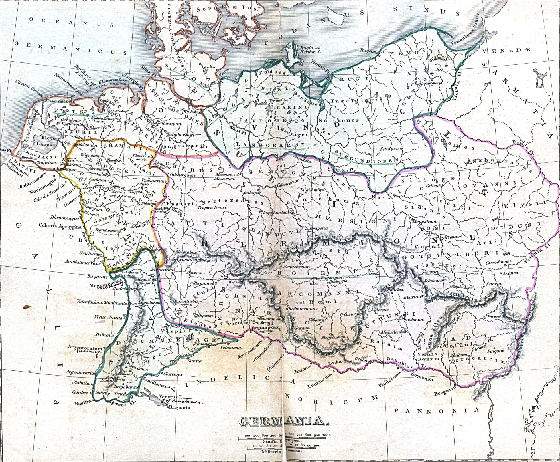
Ancient
Germany University of Texas collection
-
Barbarian
Migrations
-
Britain
5th Century
-
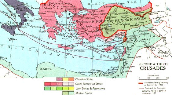
Map
of the Second and Third Crusad
-
Map
of the Forth Crusade
-
Dutch
Cities Over 30 maps from a 1652 atlas
-
Clickable
map of Florence
-
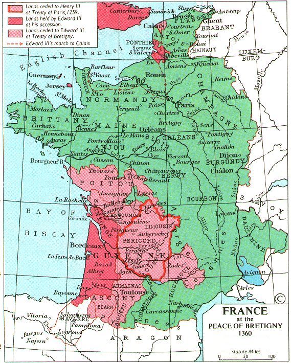
France
1360
-
France
1429
-
France
late 15th Century D3110
-
Early
Medieval Maps 175 Cartographic
Images from 400 A.D. to 1300 A.D.
-
European
Maps from 1-700 A.D.
-
European
Maps from 700-1600 A.D.
-
Holy
Roman Empire and Europe in 1490
-
Invasions
of the Barbarians
-
Medieval
Map Links
-
Late
Medieval Maps 200 Cartographic Images from 1300 A.D. to
1500 A.D.
-
Map
of Medieval Trade Routes
-
Medieval
Trade Routes
-
Renaissance
Maps 800 Cartographic Images from 1500 to 1700
-
Viking
Routes from 8th to 11th Centuries
Moderna
-
La
exploración del mundo (pdf, 140 Kbs.)
-
El
Imperio de Carlos V (pdf, 191 Kbs.)
-
La
organización de la América española (pdf, 146
Kbs.)
-
El
mundo tras la Paz de Westfalia (pdf, 156 Kbs.)
-
Principales
reinos absolutistas durante el siglo XVIII (pdf, 131 Kbs.)
-
Renaissance
Maps 1500-1870
-
North
African Coast and Strait of Gibraltar
-
Cadiz
harbour, showing Spanish and English dispositions during Drakes' raid of
29 April 1587
-
Anglo-Dutch
attack against Cadiz in 1596
-
Historic
Maps of Dutch
Cartographers
-
Janssonius
1658
-
Peter
van der Krogt's
-
Medieval
and Modern Maps
of Tournai
-
Historical
Maps from Brabant
-
West-Friesland
map
-
Bodelian
Library Map room: The
Map Case
-
The
History of Cartography project. U. Wisconsin
Cultural
Maps
-
Exploring
the West from Monticello: Maps from Columbus to Lewis
and Clark
Contemporània
-
Historical
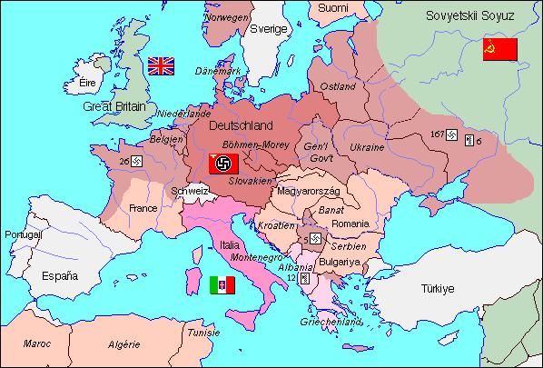
Atlas of the Twentieth Century *
-
Un
mapa de la monarquia hispànica: 1854
-
Mapas
Histórico-Políticos de la Edad Moderna (Contemporània)
-
Organització
de les Nacions Unides. Secció
de Cartografia
-
Cartes
régionales: per continents
-
Liste
des capitales, des pays et des codes de tous les États
-
Cartes
de déploiement des opérations de maintien de la paix
-
Mapa:
El
món l'any 1945
-
Mapa:
El
món avui
-
Principales
industrias europeas (pdf, 87 Kbs.)
-
El
Imperio francés en 1812 (pdf, 364 Kbs.)
-
Principales
imperios coloniales (pdf, 154 Kbs.)
-
Independencia
de Hispanoamérica (pdf, 142 Kbs.)
-
La
expansión alemana (pdf, 173 Kbs.)
-
Los
bloques en la guerra fría (pdf, 205 Kbs.)
-
La
descolonización de África y Asia (pdf, 93 Kbs.)
-
Los
flujos del petróleo en 1973 (pdf, 160 Kbs.)
-
Europa
en 1993 (pdf, 211 Kbs.)
-
El
desarrollo de la guerra civil (pdf, 338 Kbs.)
-
Resultados
del referendum constitucional (pdf, 257 Kbs.)
Més
webs per a trobar mapes històrics
-
Atles de conflictes històrics passats
i recents
The
Spanish- American War
The
Chinese Civil War
The
Great War
World
War II, The European Theater
World
War II, The Asian Theater
The
Korean War
The
Arab- Israeli Wars
The
Vietnam War
Ancient
Warfare
The
Dawn of Modern Warfare
Colonial
Wars
The
American Revolution
Napoleonic
Wars
The
War of 1812
The
Mexican War
The
American Civil War
Wars
and Conflicts Since 1958
-
Cartothèque
· Sciencies Po *
-
Atlas
y Mapas. Recopilación realizada por la BUS
-
General
Maps. Library of Congress
-
Historical
Maps Web Sites. University of Texas at Austin
-
Mapas
Histórico Políticos de la Edad Moderna.
-
Renaissance
Maps 1500-1700
-
Antiquarian
Maps
-
Atlas
Historique Périodique de l'Europe
-
Interactive
Ancient Mediterranean
-
OSSHE
Historic Atlas Resource Library
-
Periodical
Historical Atlas of Europe
-
University
of Chicago. Oriental Institut Map Series
-
Antique
Map Collection (Universitat de Yale)
The
Americas
Asia
and the Middle East
The
Far East and the Pacific
Africa
Europe
Cartographic
Curiosities
-
The
Catalan Atlas, 14th century. (BNF, ESP 30)
Exemple:
Mediterrani
i nord d'Àfrica
-
Col·lecció
Terry-Castañeda
-
Historical Maps of Africa
-
Historical Maps of The
Americas
-
Historical Maps of Asia
-
Historical Maps of Australia
and the Pacific
-
Historical Maps of Europe
-
Historical Maps of The
Middle East
-
Historical Maps of Polar
Regions and Oceans
-
Historical Maps of Russia
and the Former Soviet Republics
-
Historical Maps of Texas
-
Historical Maps of The
United States
-
Historical Maps of The
World
-
Historical
Atlas by William Shepherd (in progress)
Historical
Maps on Other Web Sites
-
Historic
Maps *
-
Cartograma.
Història de la cartografia
-
Historia
de la cartografia
-
The
Historical Atlas of the Twentieth Century
-
Historic
Atlas Resource - Europe
-
Exploring
the West from Monticello
-
USA
1895 Atlas Project
-
IE
Ireland History in Maps
-
NE
City Maps from the Blaeu Atlas 1649/1652
-
UK
City of Birmingham
-
Yahoo index for Historical
Maps
-
Civil
War Maps from American Memory
-
World
War II maps from CMH at UT
-
World
War II Maps from World War II Timeline
-
Korean
War maps from CMH
-
Links
to Historical Maps
-
Cartographic
Images
-
Mapes
històrics. Història de la cartografia
-
Old
World Maps Auctions
-
The
History of Cartography Project (University of Wisconsin)
-
Lycos
Image Gallery, Antiquarian Maps
-
Outlineof
Objects and Topics in 1492:An Ongoing Voyage Exhibit
-
1492
Exhibit (Library of Congress)
-
Centennia
: l'histoire politique de l'Europe du Xième au XXième
-
L'atlas
historique animé de l'Université de l'Oregon
-
Un
atlas historique de l'Europe de 1 à 1100 ap JC
-
Vieux
plans de Paris (Columbia Univ.)
-
Plus
de 8000 cartes postales de la France en 1900
-
Mapes
d'història (alguns muts)
-
Early
maps at Yale University
-
Antique
Maps by John Tallis, c.1850
-
Facsimiles
and Reproductions (University of California, Berkeley)
-
Dutch
City maps from the Blaeu Atlas 1649/1652
-
The
RYHINER-Projectat the (University Library of Berne)
-
Antique
maps of Iceland
-
Ancient
Maps a fascinating and useful collection
-
Antique
Maps
-
Antique
Maps - Heritage Site
-
Historical
Maps a very useful collection
-
Historical
United States County Boundary Files (HUSCO)
-
History
of Cartography Project (Univesity of Wisconsin)
-
Maps
of the PimerÍa (New Spain in the Americas)
-
The
Heritage Map Museum (Lititz, Pennsylvania)
-
Historic
Maps of Dutch Cartographers
-
Finland:
500 Years on the Map of Europe
-
Historical
Paris Maps
-
Ptolemy's
Geography and 1482 World Map (WebMuseum - Paris)
-
The
Earth & Heavens: The Art of the Mapmaker (British Museum)
-
Rare
Map Collection at the Hargrett Library, University of Georgia
-
James
Ford Bell Library's Historical Map Collection
-
An
Exhibition of Maps and Navigational Instruments
-
Map
Collection of the Galleria delle Navi del Rettorato
-
Pacific
Nortwest Railroad Maps
El
Web de les Ciències Socials, 2005


|